
Pilot Believes He Has Found Amelia Earhart’s Long-Lost Airplane
On a routine evening of scrolling through high-resolution satellite imagery, an experienced pilot paused. What appeared in a shallow reef off a remote Pacific atoll was a shape—long, linear, and suggestive of an aircraft fuselage—casting a shadow that, at first glance, seemed too regular to be a coral formation or a shipwreck. The pilot posted a cropped screenshot to a public forum with three simple words: "Could this be it?" Within days the image had moved from hobbyist chatter to global headlines, resurrecting a story that has gripped the world since July 2, 1937, when Amelia Earhart and her navigator Fred Noonan vanished somewhere during their round-the-world attempt.
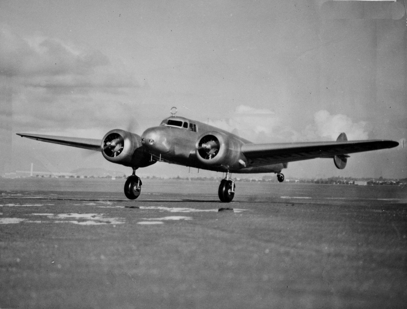
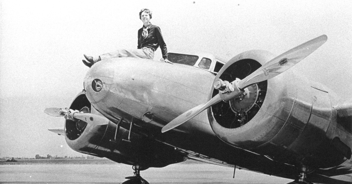
Amelia Earhart Lockheed Electra
The Claim
The essence of the claim is straightforward: a pilot using Google Earth identified a roughly plane-shaped anomaly in satellite imagery that, he believes, matches the size, shape, and orientation of the Lockheed Model 10-E Electra Earhart was flying. The discovery narrative is irresistible—an everyday tool used by a private citizen locating an object that has eluded governments, search teams, and generations of sleuths for nearly nine decades.
But spectacular claims require careful scrutiny. Satellite impressions can deceive: shadows, exposed reef, logs, and later human debris can resemble mechanical outlines in two-dimensional imagery. At the same time, the steady improvement in geospatial resolution, along with techniques such as photogrammetry and historical-image time series, give modern investigators tools unimaginable to researchers in the mid-20th century.
A Short History of the Disappearance
Amelia Earhart, already an international celebrity for her pioneering flights, left Lae, New Guinea, on June 29, 1937, with the goal of reaching Howland Island, a tiny speck in the central Pacific, on July 2, 1937. With her navigator Fred Noonan, she never arrived. Radio transmissions indicated difficulty finding the island; subsequent messages suggested low fuel. The U.S. Coast Guard cutter Itasca and naval vessels conducted a multi-day search but ultimately reported no sighting of the Electra.
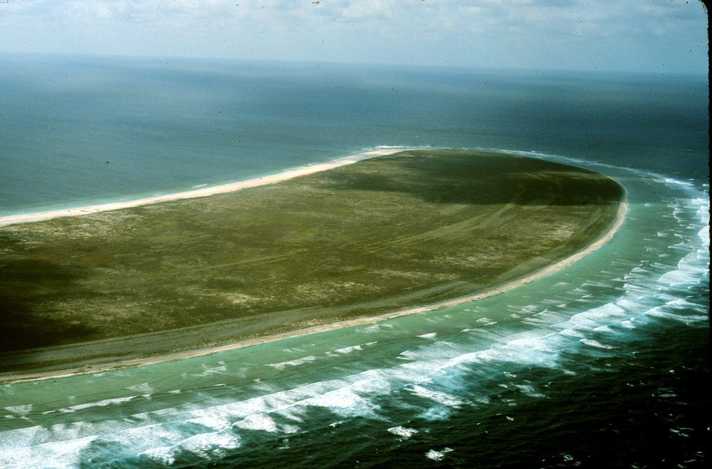
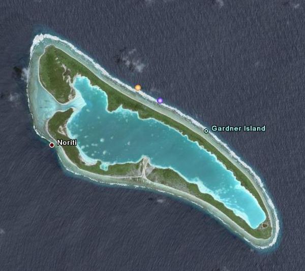
Since then, theories have proliferated: a controlled ditching at sea, a forced landing on the reef of Nikumaroro (formerly Gardner Island), capture by foreign powers, or catastrophic failure with debris scattered widely by ocean currents. Over the decades, expeditions have combed probable zones with ships, divers, magnetometers, and later, autonomous underwater vehicles and side-scan sonar. Some teams have found artifacts and bones that prompted intriguing leads, yet none have produced the incontrovertible proof—serial-numbered aircraft parts or unequivocal metalwork—from Earhart’s Lockheed Electra.
Amelia Earhart 1937 disappearance
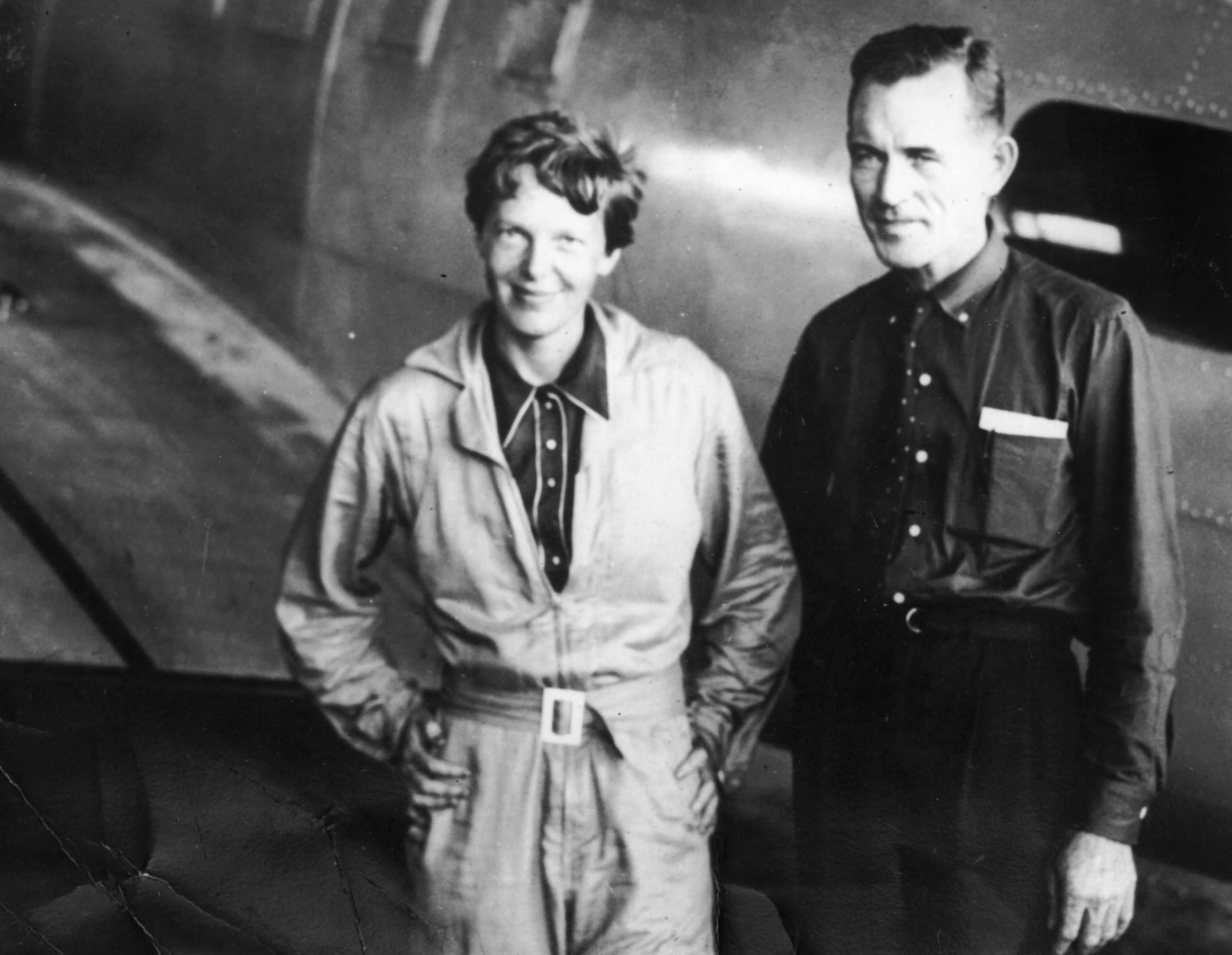
Fred Noonan navigator photo
Howland Island Pacific Ocean
Nikumaroro Gardner Island reef
Why a Satellite Image Matters
Satellite and aerial imagery have revolutionized how remote sites are surveyed. Where once researchers needed ships and helicopters to peer into vast oceanic reaches, today anyone with a strong internet connection and a trained eye can examine beaches, reefs, and shallow waters with surprising clarity. For potential crash sites near atolls, two factors make satellite images especially useful: exposed wreckage in shallows during low tides, and the fact that metallic structures can cast unusually sharp shadows against pale sand or coral.

Google Earth satellite imagery
That said, an image is only a starting point. It raises questions and priorities: Does the shape persist across images taken at different times and sun angles? Does it lie above or below mean low water? Is there contextual evidence nearby—disturbed seabed, linear scours, or clustered debris—that supports a wreck hypothesis?
How Experts Would Verify a Finding
A rigorous validation follows a multi-disciplinary path.
- Imagery triangulation: Obtain the highest-resolution imagery available for the coordinates in question, including historical archives. Confirm that the anomaly appears consistently and is not an artifact of a single image.
- Photogrammetric analysis: Use shadow length and sun-angle metadata to estimate object height and compare those dimensions to known Electra measurements.
- Contextual research: Cross-reference tides, seasonal water clarity, and recent storms to determine if natural events could explain the feature.
- Archival checks: Compare with wartime logs, shipping records, and prior search reports. Past expeditions sometimes documented objects that were misidentified or never fully investigated.
- Field survey: If the anomaly passes the remote tests, a professional survey—combining side-scan sonar, magnetometer sweeps, and targeted ROV dives—is the accepted next step.
Only fieldwork that yields identifiable, manufacture-matching aircraft components—rivets unique to Lockheed Electra construction, a serial number plate, or instrumentation—can convert a promising satellite sighting into a conclusive discovery.
"A single pixel can start a conversation, but it takes layered science to close the case."
What Makes Satellite Identifications Tricky
Remote detection is prone to false positives. Coral bommies with linear algae growth, shipping containers, the skeletons of sunken fishing boats, and even weathered logs can mimic metallic silhouettes. Light angle is critical: some features appear present at low sun angles and vanish when the sun rises higher. Conversely, a genuine metallic object buried under a thin sediment layer may be invisible until a storm scours the seabed and exposes it.
The Archaeological and Ethical Stakes
Finding Earhart’s plane would be an extraordinary historical moment with human and ethical dimensions. If wreckage is discovered, it may contain human remains and personal effects deserving of respectful treatment and careful forensic analysis. Governments, descendant families, and international bodies could be involved. There are also legal frameworks about salvage rights, cultural heritage protection, and environmental impact on fragile reef ecosystems.
A responsible approach balances the human need for closure with scientific rigor and conservation. Recovery can mean excavation and transport, but it can also mean in situ documentation and non-invasive sampling when recovery would cause more harm than good.
What Would a Confirmed Find Look Like?
From a practical perspective, a confirmed Earhart Electra would likely present these hallmarks:
- Material consistency: Aluminum alloy structures, recognizable stringers, ribs, and skin panels consistent with 1930s aircraft construction.
- Dimensional match: Measurements aligning with the Lockheed Model 10-E Electra’s known specifications.
- Manufacturer marks: Stamped parts, serial numbers, or maker’s plates that can be traced in Lockheed records.
- Associated artifacts: Items such as navigation instruments, personal belongings, or distinctive fittings consistent with Earhart’s Electra.
Absent those elements, reasonable doubt will persist.

Lockheed Model 10-E Electra wreckage
Skepticism Is Healthy—But So Is Curiosity
Curtailing enthusiasm risks missing discoveries, while credulity risks misinformation. The modern era has democratized discovery: citizen scientists and pilots using tools like Google Earth have played legitimate roles in locating lost ships, impossible-to-reach archaeological sites, and ecological phenomena. But the path from a cropped screenshot to historical confirmation is long and methodical.
Local authorities and scientific institutions should be notified if a credible coordinate is offered. Ideally, collaborative frameworks involving maritime archaeologists, forensic anthropologists, and conservation agencies will guide any field action.
Next Steps for the Pilot and the Public
If you find something similar while browsing satellite imagery, here is a practical checklist to follow before publicizing the find:
- Record exact coordinates, image metadata, and date/time stamps.
- Check multiple imagery sources and times to see persistence.
- Search historical records for prior mentions of objects at that location.
- Contact professional organizations—maritime archaeology departments, universities, or government heritage agencies—before mounting a private expedition.
- Preserve context: avoid tampering or attempting recovery without permits and experts.
Responsible reporting of potential discoveries honors both science and the memory of those lost.
Why This Story Captures the Imagination
Earhart’s story combines celebrity, pioneering spirit, and the final, unresolved tension of disappearance. It’s an archetypal narrative: a modern sleuth uses accessible technology to revisit a decades-old mystery. The idea that a single image could provide closure after 90 years is appealing, but the deeper lesson is about process: the way knowledge advances when curiosity is paired with method and humility.
The Broader Impact on Historical Investigation
Whether or not this particular satellite anomaly proves to be Earhart’s Electra, the episode illustrates how the tools of discovery have changed. Remote sensing, crowd-sourced analysis, and interdisciplinary verification now sit at the heart of many historical inquiries. That has practical implications for funding, for how archives are maintained, and for how descendants and stakeholders engage with potential finds.
Conclusion
The pilot’s Google Earth sighting is a compelling chapter in the long story of Amelia Earhart’s disappearance. It is precisely the kind of observation that keeps the search alive—and it is precisely the kind of observation that must be tested, verified, and, if necessary, debunked through patient science. For now, the image belongs to a long list of leads: tantalizing, worthy of further investigation, but not yet definitive.
- Satellite imagery can reveal promising leads for maritime and aviation archaeology, but images alone rarely provide conclusive proof.
- Amelia Earhart vanished on July 2, 1937; any claimed discovery requires multidisciplinary verification and respectful handling.
- Responsible investigation involves imagery analysis, archival research, professional survey methods, and adherence to legal and ethical standards.
The magic of the story is not in one pixel but in the interplay between modern tools and age-old questions. If the Electra is indeed resting on a Pacific reef, satellite imagery may have opened the door. But to cross the threshold we need careful eyes, trained hands, and public stewardship that places truth and respect above sensational headlines.