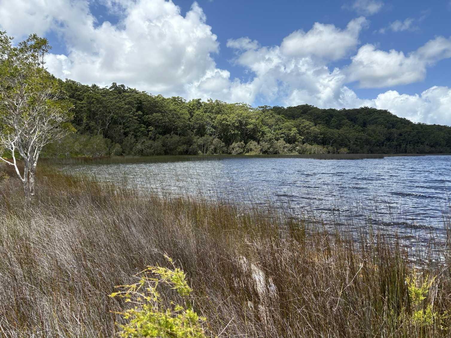
K’gari’s Lost Lakes: How Rain Couldn’t Stop an Ancient Drying
A ghostly paradox sits in the sands of K’gari: layers of lakebed silt and pollen that tell of lakes once full of freshwater, then abruptly empty — not during a long dry spell, but during a time when the island received more rain than usual. To anyone who watches rain fill a puddle or a billabong, this sounds wrong. Yet the geological and cultural records converge on a true, perplexing event. Understanding how lakes on the world’s largest sand island could dry while the skies were generous requires thinking beyond rainfall alone — and that shift in perspective illuminates how fragile coastal freshwater systems really are.
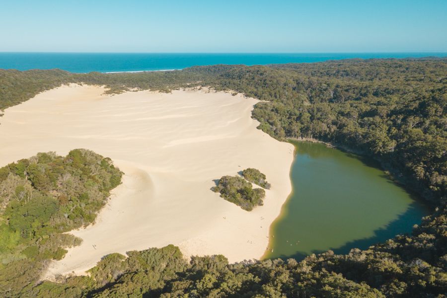
K'gari Fraser Island sand island
Perched lakes respond to more than rain: dune movement, groundwater gradients, storm breaches and fire can turn abundance into sudden scarcity.
Why K’gari’s lakes matter
K’gari — known to many as Fraser Island — is a place of striking contrasts: towering rainforest growing on sand, freshwater lakes that sit above the local water table, and a living cultural landscape maintained by the Butchulla people. The island’s perched lakes are ecological jewels. They supply fresh water to wildlife and plants, host distinctive aquatic communities, and act as natural archives of past climate because each year’s biological material and mineral dust can settle into layered sediment.
Perched lakes: what they are and why they’re fragile
Perched lakes are unusual because they rest above the regional groundwater table, sealed by a layer of organic matter, compacted humus, or fine clay that prevents water from percolating downward. On sand islands like K’gari, supply and retention of water depend on a delicate balance: rainfall to refill lakes; vegetation to stabilize dunes and build the sealing layer; and quiescent shorelines that keep sand from being washed into or out of basins. Because these systems sit on unconsolidated sand, they are especially susceptible to physical disturbance.
The ancient paradox: drying in a rainy era
Core samples pulled from several of K’gari’s lakebeds reveal a sequence that alarms and fascinates scientists. Deep, organic-rich sediments show long stable phases; then come thin, oxidized layers and windblown sand prisms signaling exposure and sediment transport — indicators of lake desiccation. Yet pollen assemblages and other proxies in the same horizons suggest wetter regional conditions: more rainforest species, greater organic deposition, signs of higher runoff. How could lakes go dry when the region became wetter on average?
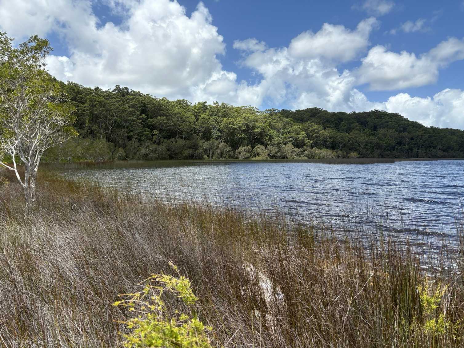
K'gari perched lake sediment cores
Mechanisms that reconcile the contradiction
To untangle the paradox, it helps to stop treating rainfall as the single controlling variable. Several interacting mechanisms can cause perched lakes to dry during periods of increased rainfall:
- Dune reorganization and breaching: Heavy storms and persistent wet periods can increase storm surge and wave energy, shifting sand and cutting through dune barriers that once protected lake basins. A single breach can create a new drainage pathway, flushing lake water to the sea regardless of how much it rains afterward.
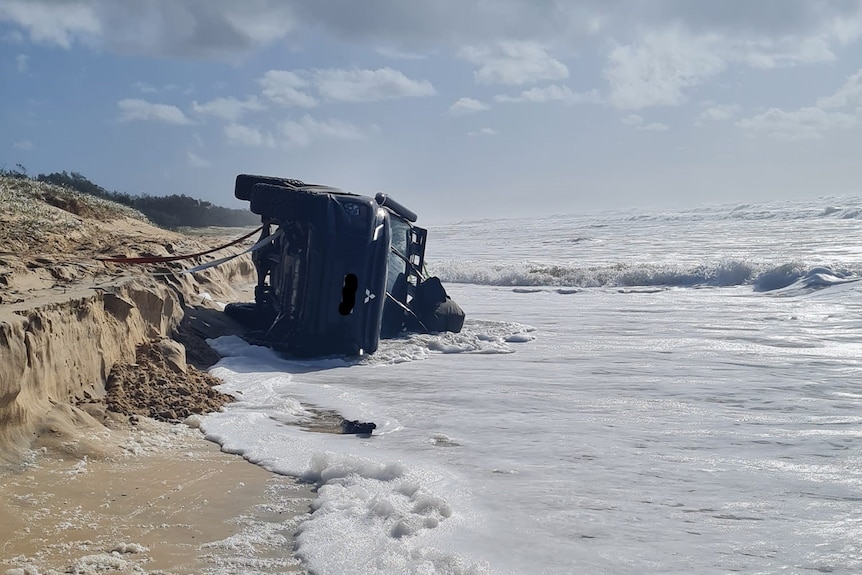
K'gari dune breach storm erosion
- Hydraulic gradient reversal: Increased rainfall inland or rising sea levels can alter groundwater flow directions. If subsurface gradients shift, perched lakes that once gained from local seepage may instead lose water to neighboring aquifers or to the ocean.
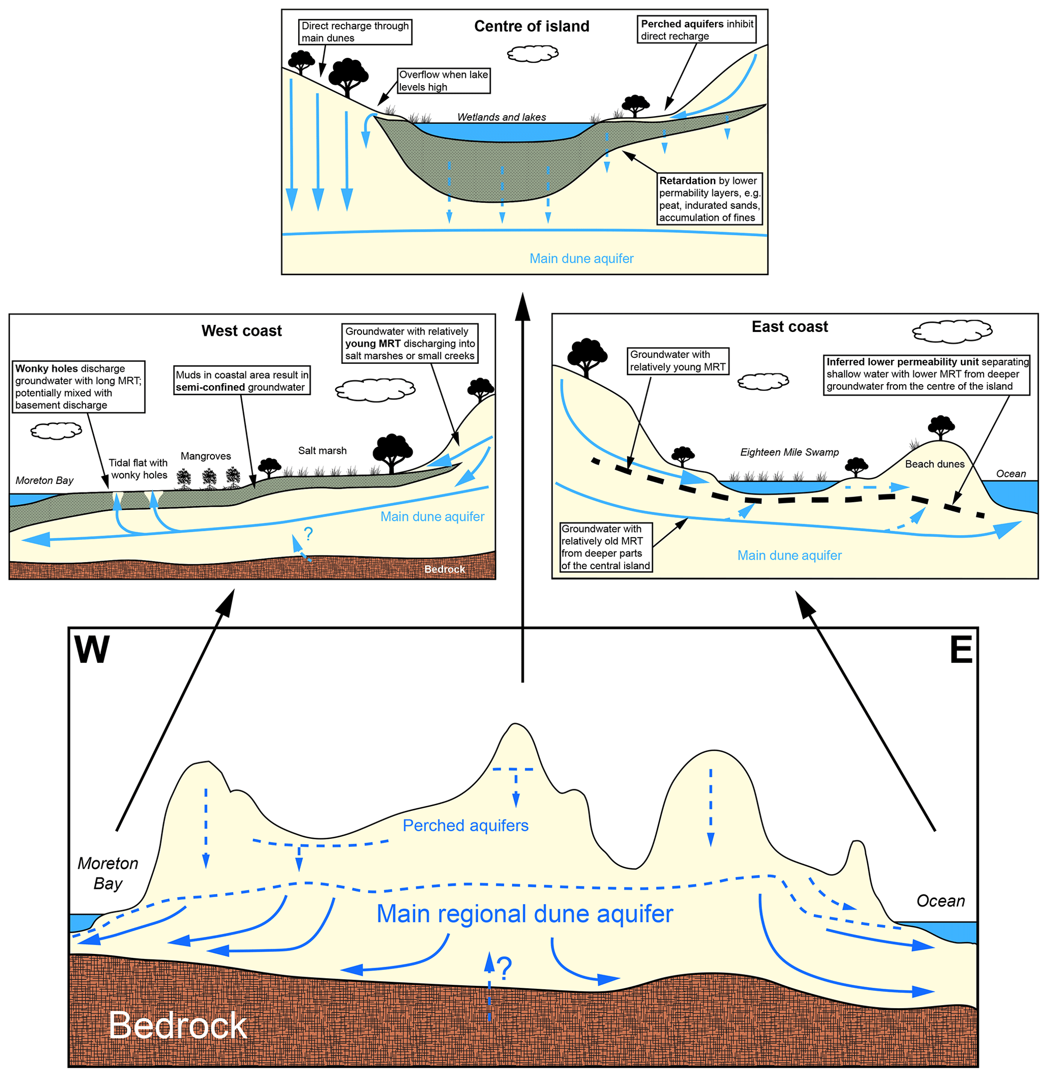
Sand island groundwater gradient hydrology
- Seal breakdown through combustion and oxidation: Frequent wet-dry cycles or intense fires can destroy the organic or clay pan that holds water. Without an intact seal, infiltration into the sand accelerates even under persistent rainfall.
- Vegetation change affecting evaporation and retention: A shift toward plants with higher transpiration rates—triggered by subtle climatic warming or nutrient pulses—can raise evapotranspiration, offsetting higher rainfall.
- Increased connectivity with saline systems: Storm surges or dune erosion can introduce salt, changing lake chemistry, killing peat-building vegetation, and collapsing the seal that created the perched condition.
None of these factors alone is guaranteed to empty a lake. The mystery resolves when we see them acting together: wetter climate increases storm intensity and vegetation growth, which in turn accelerates dune mobility and groundwater shifts. The lakes respond not linearly to precipitation but to a compound of hydrodynamic, geomorphic and ecological changes.
What the sediments and biological clues tell us
Lake sediment cores act like pages in a slow journal. Grain size, color and organic content reveal whether a basin was open water, peat-forming marsh, or dry ground. Pollen and microscopic organisms such as diatoms map out plant communities and salinity histories. In the K’gari sequences, a typical signature for the drying interval might include:
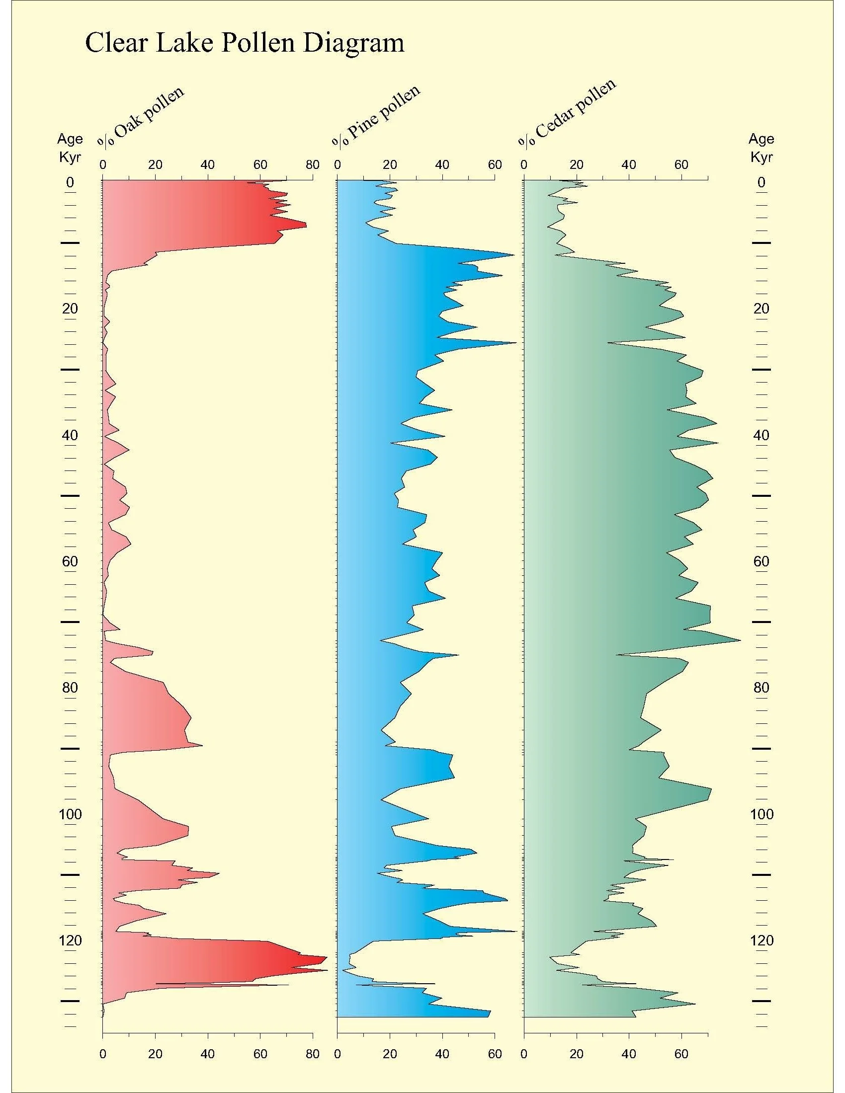
Lake sediment analysis pollen diatoms
- Sand lenses and coarse material: An influx of windblown or storm-driven sand into the basin.
- Oxidized horizons: Iron staining and leaf litter layers showing prolonged exposure to air.
- Pollen shifts: Increased representation of rainforest taxa (indicative of regional wetness) alongside a rapid decline in peat-forming sedges and aquatic plants.
- Salinity indicators: Diatom assemblages that briefly include brackish-tolerant species where previously only freshwater species existed.
That mix — wetter regional flora, but signs of local drying and occasional salinity incursion — points directly to processes that changed the basin’s physical connectivity rather than a simple regional drought.
Voices in the sand: Butchulla knowledge and oral history
Long before coring rigs arrived, the Butchulla people understood the island’s moods. Many Indigenous accounts recall lakes that changed, moved, or “went to the sea” — language that can describe breaches, shifting dunes, or ecological collapse. When geological evidence is read alongside oral memory, patterns become clearer: episodes of rapid landscape change are not merely academic; they are remembered, encoded in place names, and embedded in stewardship practices.
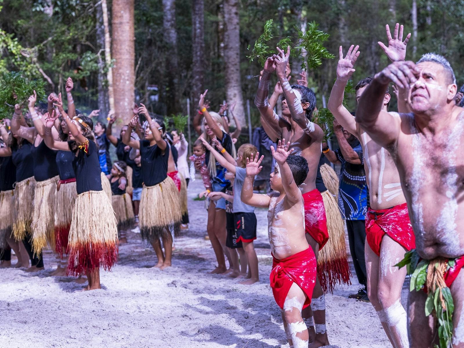
Butchulla people cultural knowledge
Analogs and experiments: lessons from other sandy coasts
Similar paradoxes have been found on other dune-dominated coasts. In some Mediterranean and New Zealand dune lakes, researchers have documented desiccation following periods of increased storm frequency and vegetation succession. In controlled models, raising mean precipitation while intensifying storm-driven sediment transport often produces net loss of water-holding capacity in perched basins. These parallels help validate the multi-causal explanation for K’gari.
Why this ancient episode matters today
This is not only a story of the past. Coastal managers face the same interplay of forces now: sea-level rise, more energetic storms, altered fire regimes, and invasive species. K’gari is a microcosm of what many low-gradient coastal systems may endure. Lessons from the island’s ancient sequences can inform resilience strategies:
- Protect dune integrity: Maintaining vegetation that stabilizes dune barriers reduces breach risk.
- Monitor groundwater gradients: Observing subsurface flow can give early warning when perched basins shift from gaining to losing conditions.
- Preserve organic seals: Minimizing activities that burn or erode peat and humus layers keeps lakes sealed.
- Engage Indigenous stewardship: Working with Butchulla custodians can integrate traditional burning, cultural monitoring and place-based management into contemporary conservation.
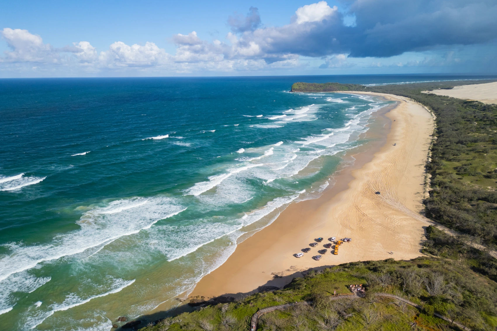
K'gari coastal conservation management
The island’s past teaches that abundant rain is no guarantee of freshwater security on sand islands.
Conservation tensions: tourism, access and ecological stability
K’gari draws visitors who come to experience its lakes, dunes and rainforests. But human use intensifies dune trampling, drives off-road vehicle tracks that alter drainage, and increases fire ignition risk. On a landscape where water-holding is a function of subtle seals and intact vegetation, such pressures can tip systems toward the very failures recorded in the geological past.
What scientists still want to know
Important questions remain. Pinpointing the precise timing and duration of the drying episodes requires high-resolution radiocarbon chronologies and multiple cores from different basins. Quantifying how much oceanic influence occurred during breaches — and how quickly landscapes re-vegetated — will refine models of recovery. Equally vital is integrating climate records from the mainland to separate local geomorphic drivers from larger atmospheric shifts.
A research agenda
- Paired coring: Collect synchronous cores from multiple adjacent lakes to compare local versus regional responses.
- Isotope studies: Use stable isotopes to trace water sources and evaporation rates through time.
- Geomorphic mapping: Reconstruct historical dune forms and breach pathways with sediment mapping and LIDAR where available.
- Collaborative frameworks: Co-design research with Butchulla custodians to ensure cultural priorities guide scientific questions.
Conclusion: an ancient mystery, modern warning
The episode when K’gari’s perched lakes dried during a rainy era is a powerful reminder: ecosystems are mosaics of interdependent processes. Rainfall is essential, but not omnipotent. Physical reorganization of the landscape, changes in subsurface flows, ecological shifts after fire or salt incursion, and human influence can conspire to convert abundance into loss. For K’gari, the past is both mystery and guidepost — inviting scientists, managers and Indigenous custodians to read the sedimentary story carefully and act with humility and urgency to protect these fragile freshwater jewels.
- Perched lakes on K’gari can dry even during wetter climatic phases due to geomorphic and hydrological reorganization.
- Multiple interacting drivers — dune breaches, groundwater gradient changes, seal breakdown and vegetation shifts — explain the paradox.
- Indigenous knowledge and sediment records together provide the fullest picture of past change and inform resilient management.
Lake sediments, oral memory and modern science together reveal how the island’s freshwater systems can fail even when rain increases.