Artemis II Captures a Stunning High-Resolution Image of Earth
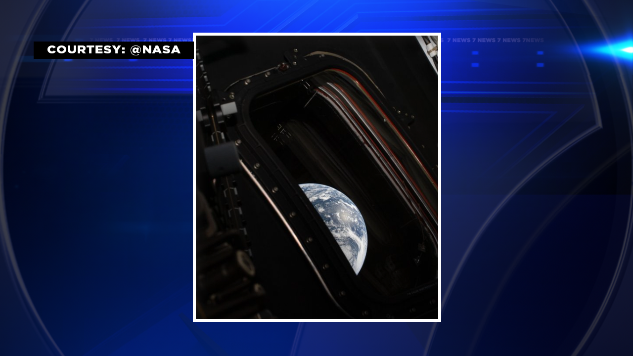
The moment a spacecraft bound beyond low Earth orbit turns its cameras back toward our planet, ordinary geography becomes a revelation. A newly released, high-resolution photograph taken by the Orion spacecraft during the Artemis II mission reveals an Earth that is at once familiar and newly intimate — a living, dynamic sphere traced in crisp coastal outlines, weather systems, and the thin blue veil of atmosphere. More than a pretty picture, this image is a multilayered artifact of engineering, science, and public imagination: it demonstrates how deep-space missions can contribute to Earth observation, illustrates the rapid progress in spaceborne imaging technology, and provides a modern echo of the storied Blue Marble photographs that shaped public consciousness decades ago.
SECTION TITLE
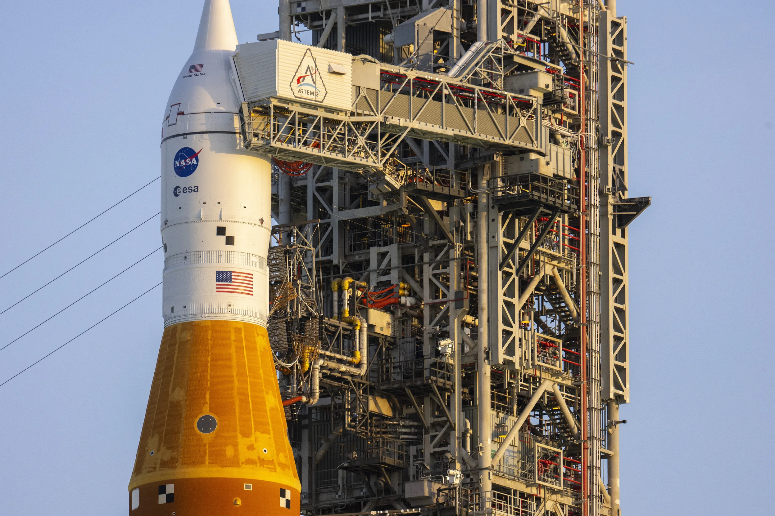
Orion spacecraft Artemis II
First Impressions: The Picture and Its Power
The photo stands out immediately for its clarity and composition. A wide-angle view captures a rich palette — swirling cloud bands, sharply delineated coastlines, and lighting that emphasizes topography in surprisingly detailed ways for a shot taken from cislunar distance. Where older space photography sometimes sacrificed resolution for a broader perspective, this image manages both: large-scale context and small-scale texture coexist. That combination is what makes recent images from crewed deep-space missions uniquely compelling.
This photograph is a reminder that viewing the whole Earth from afar sharpens both our scientific questions and our sense of shared stewardship.
How the Shot Was Made
The technical story behind the image is a quiet triumph. Cameras aboard crewed spacecraft are designed first and foremost for mission operations and crew needs, but the addition of high-fidelity imaging suites and optimized exposure strategies has unlocked new possibilities. To achieve this level of detail from a trajectory that takes Orion beyond lunar distance requires careful attention to:
- Platform stability: Minimizing vibration and motion during exposure windows preserves fine detail even when the spacecraft is reorienting for navigational purposes.
- Exposure control and dynamic range: Capturing both bright cloud tops and dim oceanic features demands sensors capable of high dynamic range and multiple exposure techniques.
- Optical design: Lenses and sensor assemblies must balance wide field of view with minimizing distortion and chromatic aberration.
- Data handling: High-resolution images generate large files that must be buffered, compressed losslessly or with minimal quality loss, and prioritized for downlink alongside mission telemetry.
Put together, those pieces create a modern imaging pipeline that turns raw photons collected in space into a usable scientific and public resource.
Subsection: Complementing Earth Observatories

NASA Artemis II mission
SECTION TITLE
Orion’s Perspective: Why a Deep-Space Angle Matters
Observing Earth from cislunar space — the region between Earth and the Moon — changes the geometry of what we can measure. Ground-based and low-orbit platforms excel at high revisit frequency and fine spatial resolution over narrow swaths; deep-space vantage points offer sweeping context, consistent illumination across entire hemispheres, and the ability to see planetary-scale phenomena as patterns rather than disconnected tiles.
From Orion’s vantage, entire storm systems can be tracked as coherent structures. Night-side city lights form patterns unbroken by orbital seams. The terminator — the line between day and night — is rendered with a soft, revealing gradient that highlights atmospheric scattering. These are not merely aesthetic outcomes; they translate directly into scientific value when used alongside higher-resolution, higher-frequency observations from dedicated Earth-observing satellites.

Earth from cislunar space
Subsection: Complementing Earth Observatories
Think of Artemis II's image as a very wide-angle lens in a camera bag full of specialized instruments. It is not a replacement for polar-orbiting environmental satellites, but it is a complementary snapshot that enhances interpretation. When scientists combine a cislunar image with higher-resolution local datasets, they can:
- Place local changes in global context, seeing whether a regional event is part of a broader climate or weather pattern.
- Identify large-scale transport pathways, such as aerosol plumes crossing oceans or transcontinental dust movement.
- Validate models of radiative transfer and atmospheric composition by comparing observed scattering signatures with simulated outputs from climate models.
SECTION TITLE
Scientific Uses: From Climate Signals to Coastal Monitoring
Deep-space imaging technology
Apollo-era photographs already taught scientists and the public about the fragility and beauty of Earth. Today's higher-resolution deep-space images carry added scientific promise. Because they capture broad swaths with consistent geometry and illumination, they can be used to study phenomena such as:
- Large-scale cloud dynamics: Convection patterns, storm merging, and mesoscale organization are easier to interpret when visible across hemispheric scales.
- Aerosol transport: Dust, smoke, and volcanic plumes can be traced across ocean basins, helping to constrain source strengths and transport pathways.
- Albedo and surface changes: Seasonal snow and ice cover, large-scale vegetation changes, and major coastal events show up as contrast shifts at scales resolvable from cislunar distances.
These uses depend on repeated imaging under consistent conditions. A single photograph is emblematic; repeated, calibrated captures are what transform imagery into datasets for rigorous analysis.
Subsection: Data Products and Accessibility

Blue Marble Earth photograph
For maximum impact, images like this should be delivered as curated data products: radiometrically calibrated files, with metadata describing viewing geometry, sensor characteristics, and processing steps. Such packaging allows scientists, educators, and citizen scientists to integrate the image into GIS platforms, climate model comparisons, and classroom exercises.
SECTION TITLE

Planetary-scale Earth observation
A Cultural Moment: Why One Photograph Still Moves Us
Beyond the technical and scientific utility, there is an unmistakable cultural power to seeing Earth from space. Photographs taken from distant spacecraft have a track record of shaping public understanding and policy. They can catalyze concern for environmental issues, inspire young people to pursue science careers, and provide a visual anchor for narratives about global interdependence.
Artemis II's image arrives into a media ecosystem saturated with visuals, yet images of the whole Earth retain a special status. They invite simple, universal reactions — wonder, humility, a sense of responsibility — that rarely require scientific training to appreciate. For outreach teams, this photograph is a tool for storytelling, for cutting through abstraction and making the planet's beauty and vulnerability viscerally apparent.
Subsection: Educational and Outreach Opportunities
Teachers and communicators can use the image to:
- Introduce concepts such as scale, remote sensing, and atmospheric optics to students of all ages.
- Create comparative modules that pair Artemis II imagery with satellite time series to show change over time.
- Launch citizen science campaigns that ask the public to identify features or report coincident observations, enriching datasets with ground truth.
SECTION TITLE
Spacecraft camera imaging system
How This Image Compares to Historic Views
When the first Blue Marble images circulated, they had a profound effect because they offered a novel global perspective. Subsequent missions — from weather satellites to dedicated Earth-observers — added resolution and cadence. Artemis II's image sits at the intersection: it is closer to the Blue Marble lineage in its holistic framing, yet it carries resolution improvements inspired by advances in sensor technology over the past decades.
Comparisons are useful: whereas low-Earth platforms offer pixel-level detail of cities and even roads under ideal conditions, a cislunar image emphasizes system-scale phenomena. The two approaches are complementary; alongside each other they provide a more complete picture of how local processes integrate into global systems.
Subsection: Aesthetic and Technical Lineage
The aesthetics of planetary photography follow both scientific and human impulses: good lighting, strong composition, and contrast that reveals structure. Technically, the lineage runs from film cameras of early missions through to modern digital sensors with high dynamic range and precision timing. Artemis II's result reflects that long evolution in both taste and technology.
SECTION TITLE
Looking Ahead: What This Means for Future Missions
This photograph raises practical questions as well as inspirational ones. Should future deep-space missions include dedicated Earth-observation packages? What are the science cases that justify routine, high-quality imaging from cislunar space? The answers point toward a hybrid approach: occasional high-value observations from crewed missions, supplemented by dedicated small satellites and ground-based networks for temporal depth.
Potential future developments include:
- Standardized imaging suites on crewed deep-space vehicles to ensure consistent, calibrated datasets.
- Coordinated campaigns that time cislunar imaging with overpasses of polar-orbiting satellites for multi-scale studies.
- Open archives and APIs to enable researchers and educators to access and analyze imagery quickly.
- Unique perspective: Planetary-scale context.
- Public impact: High engagement potential.
- Low revisit rate: Limited temporal coverage.
- Not a replacement: Lacks the fine-scale, frequent data of dedicated satellites.
SECTION TITLE
Practical Considerations for Scientists and Mission Planners
To turn single images into long-term value, agencies and researchers should agree on standards for calibration, data release, and mission planning. Calibration ensures that brightness and color can be compared across epochs; metadata ensures correct geolocation and interpretation; and release policies determine who can use the data and how quickly. These logistical factors are as important as optics when it comes to scientific utility.
Subsection: Policy and Collaboration
Meaningful scientific returns often require collaboration across agencies, nations, and disciplines. Creating coordinated observation campaigns that include crewed missions, remote-sensing satellites, and in situ measurements would magnify the impact of single images and help translate them into actionable insights for climate and environmental monitoring.
SECTION TITLE
Conclusion: A Picture That Opens Questions
The new high-resolution photograph from Artemis II is emblematic of where space exploration and Earth science intersect today. It affirms that crewed deep-space missions can contribute meaningfully to our observation of Earth, not only by generating images that inspire, but by offering contextual datasets that scientists can use in combination with targeted satellites and models. The image invites practical follow-up — standardized imaging, repeat observations, and open data — while also delivering an immediate cultural and educational payoff.
As space agencies plan the next generation of missions, integrating thoughtful Earth-observation capabilities into broader exploration objectives will multiply the return on investment: each mission can become a platform for discovery both off-world and at home.
Seen from afar, the planet's fragility becomes obvious — and actionable.
A high-resolution view of Earth taken from the Orion spacecraft during the Artemis II mission. The image highlights cloud patterns, coastlines, and the thin atmospheric limb.
- Artemis II's high-resolution photograph demonstrates the value of deep-space imaging for global context and public engagement.
- Images from cislunar distances complement, rather than replace, dedicated Earth-observing satellites by providing planetary-scale perspective.
- Scientific usefulness increases when images are delivered as calibrated data products with comprehensive metadata.
- Coordinated observation campaigns and open data policies would maximize the scientific and educational impact of such images.